
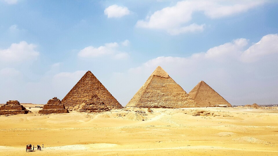
It's hard to believe: the ancient Egyptians used to use a river as a transport route in this desert landscape. Thanks to the latest satellite technology, researchers can now reconstruct the landscape structures beneath the sand. (Symbolic image, source: Osama Elsayed via Unsplash)
Advertisement
A few days ago we reported on the dangers of a satellite crash, as much of our modern world is now dependent on this technology.
What you may not have noticed: Even archaeologists now use radar satellites and discovered something amazing in Egypt's pyramids a few months ago.
Why we report on it: Many areas of our everyday life are now closely linked to the most modern satellite technology – even when researching our past. Archaeologists discovered:
- A former riverbed called Ahramat
- A connecting canal between 38 ancient Egyptian pyramid complexes
- An explanation for the transport of millions of tons of stone blocks
In detail: How could the Egyptians with their ancient means and tools millions Transport stone blocks to their building sites? Researchers have been asking themselves this question for a long time.
Advertisement
A speculation: They moved their heavy building materials across the water using ships – but today an arm of a river or canal can no longer be discovered from the ground.
- Today there is only sand around the pyramids.
- Proving this waterway thesis on the ground is extremely difficult.
Worth seeing: This is what the Great Pyramid of Giza looks like. In this two-minute clip there is also an animated graphic that shows how you can imagine the inner workings of this gigantic structure:
Link to YouTube content
Satellite technology helps archaeologists: This is where our most modern radar satellite technology comes into play. This can be used to create more accurate images:
- Radar waves penetrate the ground
- Can make underground terrain visible
- Result: Detailed images show soil conditions
The discovery supports the waterway thesis in pyramid building
A former river becomes visible: The researchers evaluated the images and discovered sections of the dried Ahramat River. After additional ground drilling, they were, according to them study secure:
The analysis of radar satellite data […] has led to the discovery of the ancient branch of the Nile Ahramat (Arabic for pyramid arm), which flows past the pyramid chain between Faiyum South and Giza North (~ 38 pyramid buildings).
Worth seeing: If you want to experience the history of Egypt up close, you can play the strategy game Total War: Pharaoh gamble. In our test video you can see how you can guide the fate of your ancient people on the Nile:

![]()
15:23
Total War: Pharaoh – test video for the strategy game on the Nile
And not only that: Dozens of tributaries have also been discovered. According to the researchers, these were used as protected lagoons – i.e. as anchorages for their ships.
Why is this special? So far, scientists are still arguing about how people created stone blocks weighing up to 4,000 years ago 2.5 tons from the quarries to the distant construction areas of the pyramids.
[…] The findings suggest that this former arm and its tributaries were active simultaneously in the Old Kingdom and the Middle Kingdom at the time the pyramids were built.
From Study – The discovery of the Ahramat Nile branch: a hidden ancient waterway of the Egyptian pyramid chain
In other words: The people of that time used the river for centuries to transport goods and people – and to transport the large stones?
At least, thanks to the satellite images, this study provides another pro-water argument that proves the feasibility of such a project. Even earlier ones Studies have studied branched and long-dried branches of the Nile in order to better understand the work of the Egyptians.
However, it still cannot be proven 100 percent how exactly our clever ancestors supplied their gigantic structure with the necessary stones – long before the invention of cargo cranes or satellites.